Tropical Storm Beryl is intensifying in the Gulf of Mexico, poised to regain its status as a Category 1 or 2 hurricane before making landfall on the mid-Texas coast early Monday morning. The National Hurricane Center is warning of significant flooding threats from tidal surges and intense rainfall.
Beryl’s winds have already reached 65 miles per hour, with higher gusts, and are expected to strengthen further to Category 1 hurricane speeds of up to 85 miles per hour. In some scenarios, the storm could reach Category 2 status.
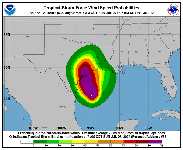
The greatest danger posed by Beryl will come from tidal surges of four to six feet between Matagorda Bay and San Luis Pass, as well as localized rainfall totals of up to 15 inches. The National Hurricane Center is also forecasting the possibility of tornado activity along the middle and upper Texas coastal region.

In the face of these warnings, surfers braved the conditions near Port Aransas, Texas, despite officials’ warnings of life-threatening dangers from the heavy surf and rip currents.
Hurricane-force winds are expected to reach the Texas coastal region by midnight Monday morning, with the storm set to make landfall near Matagorda Bay. After inland passage, Beryl is predicted to turn northward west of the Houston metropolitan area and then northeast into deep East Texas by Monday afternoon.